[caption id="attachment_1003731433" align="aligncenter" width="433"]
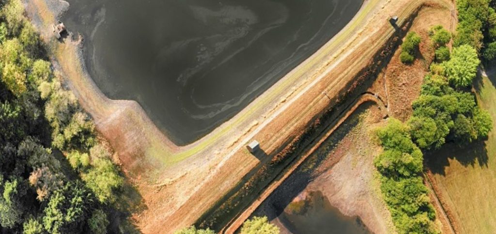
 Inmarsat and Glass Terra have teamed up to improve tailings management.
[/caption]
LONDON, U.K. –
Inmarsat, the world leader in global, mobile satellite communications, will collaborate with geo-spatial internet of things (IoT) specialist
Glass Terra to integrate Inmarsat’s tailings dam monitoring solution with Glass Terra’s IoT light detection and ranging (Lidar) capabilities. The combined solution will provide complementary real-time technologies to deliver transparency to tailings facility management in Australia.
Uniting Inmarsat’s instrument monitoring and Glass Terra’s IoT Lidar solution will enable technicians and audit, store or monitor the structural integrity of tailings dams, as well as piezometric pressure, water quality and flow rate in real-time, to allow for more informed and safer tailings management.
To achieve this, Glass Terra will provide Lidar scanning devices to build a three-dimensional picture of the dam and detect whether there has been any soil slippage or movement in the embankment. Inmarsat will deploy its instrument agnostic solution, which visualises key data on its cloud dashboard via its highly reliable broadband global area network (BGAN) satellite connectivity, allowing miners to proactively manage their tailings facilities.
Sophia Li, CCO of Glass Terra, said, “Real-time monitoring of tailings facilities’ embankments enables prompt reporting. Investigation and mitigation of high potential incidents can enhance the safety of tailings facilities and the safety of our community, improve the protection of our environment, and advance the social performance of the global mining industry.”
Commenting on the relationship, Joe Carr, director of mining innovation at Inmarsat, said, “We are excited about the collaboration between Inmarsat and Glass Terra, a project that will mark the first time Lidar and real-time instrument monitoring have been used in tandem like this. It represents a step change in terms of the detailed data picture that engineers will be able to access, increasing their ability to manage mine tailings facilities effectively. Satellite connectivity-enabled tailings monitoring solutions, such as those delivered by Inmarsat, can play a pivotal role in providing this kind of transparency at closed mine sites where there is no connectivity infrastructure, as well as at active mines in remote areas.”
Inmarsat offers several other methods to monitor tailings. Find them at
www.Inmarsat.com/blog/a-guide-to-tailings-dam-monitoring/.

 Inmarsat and Glass Terra have teamed up to improve tailings management.[/caption]
LONDON, U.K. – Inmarsat, the world leader in global, mobile satellite communications, will collaborate with geo-spatial internet of things (IoT) specialist Glass Terra to integrate Inmarsat’s tailings dam monitoring solution with Glass Terra’s IoT light detection and ranging (Lidar) capabilities. The combined solution will provide complementary real-time technologies to deliver transparency to tailings facility management in Australia.
Uniting Inmarsat’s instrument monitoring and Glass Terra’s IoT Lidar solution will enable technicians and audit, store or monitor the structural integrity of tailings dams, as well as piezometric pressure, water quality and flow rate in real-time, to allow for more informed and safer tailings management.
To achieve this, Glass Terra will provide Lidar scanning devices to build a three-dimensional picture of the dam and detect whether there has been any soil slippage or movement in the embankment. Inmarsat will deploy its instrument agnostic solution, which visualises key data on its cloud dashboard via its highly reliable broadband global area network (BGAN) satellite connectivity, allowing miners to proactively manage their tailings facilities.
Sophia Li, CCO of Glass Terra, said, “Real-time monitoring of tailings facilities’ embankments enables prompt reporting. Investigation and mitigation of high potential incidents can enhance the safety of tailings facilities and the safety of our community, improve the protection of our environment, and advance the social performance of the global mining industry.”
Commenting on the relationship, Joe Carr, director of mining innovation at Inmarsat, said, “We are excited about the collaboration between Inmarsat and Glass Terra, a project that will mark the first time Lidar and real-time instrument monitoring have been used in tandem like this. It represents a step change in terms of the detailed data picture that engineers will be able to access, increasing their ability to manage mine tailings facilities effectively. Satellite connectivity-enabled tailings monitoring solutions, such as those delivered by Inmarsat, can play a pivotal role in providing this kind of transparency at closed mine sites where there is no connectivity infrastructure, as well as at active mines in remote areas.”
Inmarsat offers several other methods to monitor tailings. Find them at


Comments