ArcPacific finds lost gold-copper mine at LMSL property in B.C.


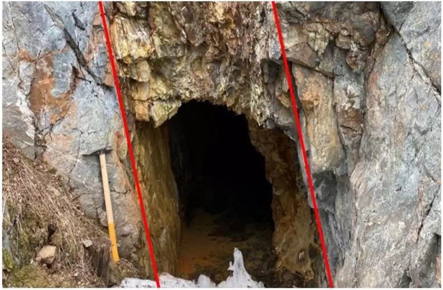
ArcPacific Resources (TSXV: ACP) found an early 1900s era gold-copper mine previously incorrectly plotted in the B.C. government database during initial work its 100% owned LMSL project. The lost mine represents one of many historic workings on the LMSL property, near Merritt in south-central British Columbia. The historic mine adit was located while infill drilling an area surrounded by anomalous copper geochemistry. Mining in this area was thought to have taken place during the early 1910s, though neither records of development nor evidence of drilling were found.
The ongoing work prioritizes target areas recently developed by GoldSpot Discoveries, across the 120 km2 project area. ArcPacific's team has identified three samples from the vicinity of the newly located mine workings, two of which assayed as follows: 50.83 g/t gold and 125.4 g/t silver, and 0.92 g/t gold and 130 g/t silver.
The historic gold-copper mine follows a mineralized fault structure located along the west side of the valley cutting Swakum Mountain. The fault orientation suggests it is likely a sub-parallel splay or branching structure related to a larger and more significant magnetic-low (fault) structure that is at least 2.5 km long within the untested valley floor.
The 2022 drilling program includes drill holes targeting the prominent magnetic-low in the vicinity of the historic mine. The planned drilling also aims to test other areas including newly developed geological vector models where increased potassic alteration is indicated proximal to historic drilling with porphyry-style mineralization.
The LMSL property is located in the Quesnel Trough, which is host to several operating copper and gold mines. The project is immediately adjacent to Teck Resources' Highland Valley mine. Also in the vicinity are Kodiak Copper's MPD porphyry discovery and the New Afton mine owned by New Gold.
For more information, visit www.arcpacific.ca.
.
Comments